
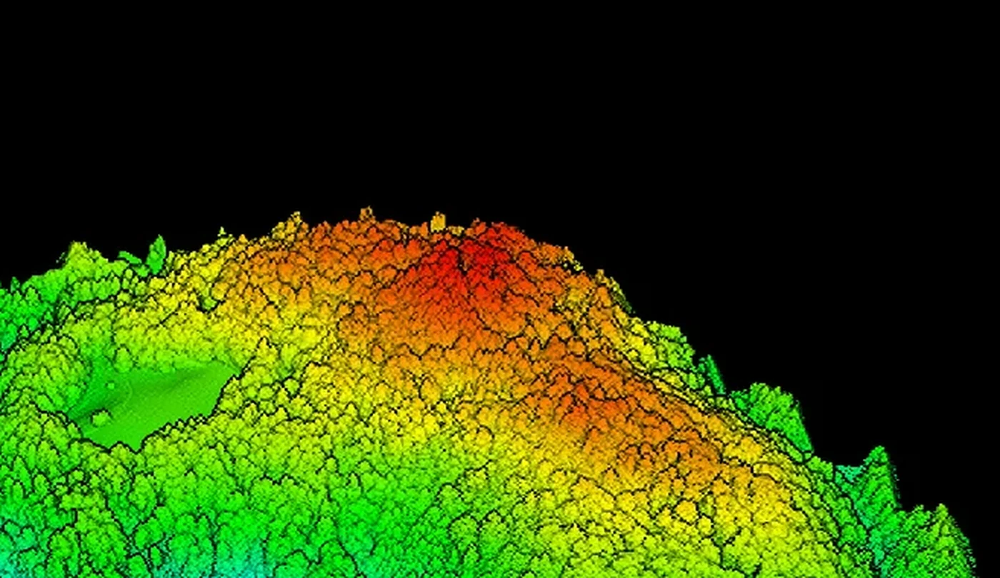
Real drone-captured LiDAR point cloud of forest terrain
Services / [LiDAR / RGB / DTM / DSM]

LiDAR drone surveying in Croatia

EnergizeDrone provides LiDAR drone surveying for forestry, infrastructure, terrain modelling and technical documentation across Croatia. The service covers flight planning, LiDAR and RGB data capture and delivery of the agreed point cloud and models.

01Mission planextent, vegetation, altitude and data goal
02Matrice 400 + L3coordinated LiDAR and RGB capture
03Agreed deliverablespoint cloud, DTM/DSM, CAD/GIS or 3D
[Short answer]

Who does LiDAR drone surveying in Croatia?

EnergizeDrone is a specialised Croatian provider of professional LiDAR and RGB drone surveying. The team is based in Zagreb and carries out projects across Croatia with DJI Matrice 400 and Zenmuse L3 equipment, mission planning, data processing and delivery according to the agreed purpose.

01Evidence

A real interactive point cloud

On this page you can explore a real LiDAR section of forest terrain, switch the canopy on or isolate the ground view. The example shows the type of spatial record, not a generated promotional illustration.

See the documented example
02System

DJI Matrice 400 and Zenmuse L3

LiDAR and RGB are captured in a coordinated mission. Flight parameters, control and processing are adapted to the terrain, vegetation, required level of detail and the format your technical team uses.

See the system
[Real data]

Explore the forest and the terrain model.

Pan the view, zoom into detail and switch between returns with trees and the classified terrain view. The number of points shown is reduced for fast web viewing.

[Applications]

When does LiDAR give a clearer basis for decisions?

LiDAR is not automatically the best sensor for every project. We choose it when spatial geometry, elevation relationships, vegetation or hard-to-reach terrain justify this method of capture.

LiDAR model of a forest and terrain coloured by height01FOREST / TERRAIN

Forestry and vegetation

Canopy structure, elevation relationships and isolation of the returns that help create a ground model, with limitations that depend on vegetation density and survey conditions.

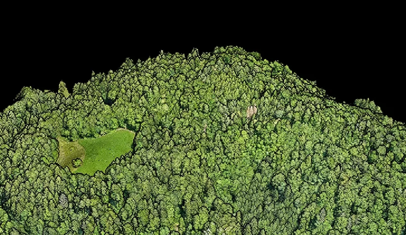
Real RGB 3D view of forest terrain only02RGB / 3D

Visual context alongside LiDAR

An RGB view of the same forest area makes it easier to orient yourself in the point cloud and check the relationship between vegetation, clearings and terrain without revealing the surroundings outside the selected section.

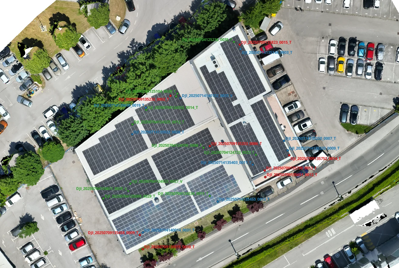
Orthophoto map as an example of a spatially organised technical deliverable03CAD / GIS

Models and technical base data

Classified point cloud, terrain and surface models, profiles, calculations or export to the agreed CAD/GIS workflow.

[From site to data]

What does a LiDAR project look like?

01

Goal and extent

We define the boundary, purpose, expected deliverables, coordinate system and how the data will be used.

02

Plan and checks

We select the flight parameters, data control and date, and check the site, airspace, Croatian Civil Aviation Agency (HACZ) procedures and the AMC Portal where applicable.

03

LiDAR + RGB flight

We capture spatial returns and visual context according to plan, checking coverage and quality before leaving the site.

04

Processing and delivery

We classify the data and prepare it in the agreed form, with clearly stated assumptions, limitations and any technical review required.

[How to choose a contractor]

Don’t just choose a drone. Choose the whole workflow.

A LiDAR surveying company should be able to explain what it captures, how it controls the data, exactly what it delivers, and where the operator’s responsibility ends and licensed professional interpretation begins.

01Check

A real data example

Ask for a real point cloud, not just a render of the equipment. The example should show the density, classification and how the results are reviewed.

02Method

Control and limitations

A serious quote states the control plan, the factors that affect the result and what cannot be concluded without an additional field or expert review.

03Delivery

A format for your team

LAS/LAZ, agreed rasters, models or CAD/GIS exports should be defined before the flight so the result does not end up as a large, unusable file.

04Responsibility

A clear purpose for the data

LiDAR surveying is not an automatic substitute for official certification or the work of a licensed surveyor. We involve the appropriate specialist when the purpose requires it.

[FAQ]

Answers before a LiDAR survey

The exact plan, price and feasibility are confirmed after reviewing the site, the extent and the required deliverables.

Send the location
Who provides LiDAR drone surveying in Croatia?

EnergizeDrone, the operating brand of Energize Intelligent Solutions d.o.o. from Zagreb, provides LiDAR drone surveying for projects across Croatia. The team plans the mission, captures LiDAR and RGB data with the DJI Matrice 400 and Zenmuse L3 system, and delivers the agreed point cloud, terrain models and 3D data.

How do you choose a LiDAR surveying company?

Check whether the contractor uses its own suitable equipment, defines accuracy and quality control before the flight, can show a real point cloud and knows how to deliver a format that fits your CAD or GIS process. A clear scope, the limitations of the method, regulatory preparation and support after delivery also matter.

What is the difference between LiDAR and photogrammetry?

LiDAR actively measures distances with laser pulses and creates a spatial point cloud, while photogrammetry reconstructs geometry from overlapping photos. LiDAR is particularly useful for terrain, corridors and certain vegetation conditions, while photogrammetry provides rich visual texture. We choose the method according to the goal and the terrain.

Can LiDAR show the terrain under trees?

Some laser pulses can reach the ground through gaps in the vegetation, so a terrain model can be created by classifying the returns. The result depends on the density and type of vegetation, the season, the scan angle, point density and processing quality. LiDAR does not guarantee complete ground coverage under fully impenetrable cover.

How accurate is LiDAR drone surveying?

Accuracy must not be promised as a single number without data on the terrain, flight altitude, GNSS/RTK conditions, target reflectivity, control points and processing. Before quoting we define the purpose of the result and propose a control method. The final documented accuracy is stated only for a specific project and agreed methodology.

What should I send for a LiDAR survey quote?

Send the location or survey boundary, approximate area, a description of the terrain and vegetation, the purpose of the survey, the desired coordinate system, delivery format and deadline. If project documentation or an example of the required result already exists, attach it so we can assess the sensor, flight plan, control and processing.

[Project assessment]

Send us the extent.
We will put together a plan.

For an initial assessment, send the location, approximate area, a description of the terrain, the purpose of the data and the desired format. We will reply with a proposed method, the checks required and a clear scope for the quote.

Energize Intelligent Solutions d.o.o.
Trnjanski nasip V. 28, 10000 Zagreb, Croatia
+385 95 822 6318 · [email protected]
Mon–Fri 08:00–17:00