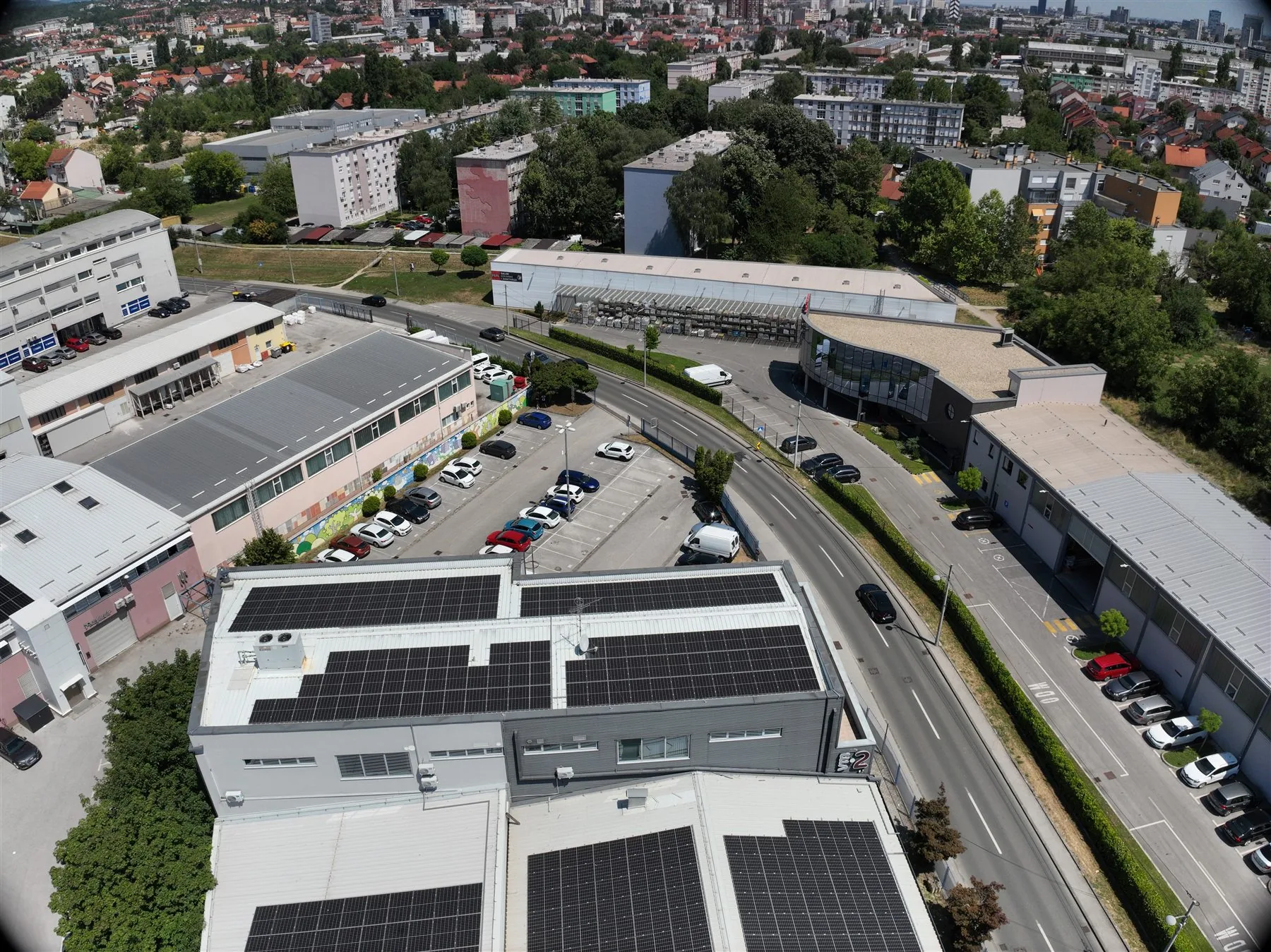
Aerial view of commercial buildings, access roads and the surrounding neighbourhood
Services / [Photography / video / location context]

Real estate drone photography in Zagreb

Real estate drone photography shows the relationship between a building, its plot and its surroundings in a way that ground-level photos cannot fully convey. In Zagreb and Zagreb County we produce photo and video material for sales, rentals, project presentations, construction monitoring and condition documentation. Before the flight we define the audience, key angles, privacy limits and how the content will be used. The goal is not a series of random panoramic shots, but a clear visual story that suits the property.

01Short creative planpurpose, key features and publishing format
02Filming on locationsafe angles, surroundings and building details
03Selection and editingphotos or video ready for the agreed channel
[Short answer]

Who does professional real estate drone photography in Zagreb?

EnergizeDrone, a brand of Energize Intelligent Solutions d.o.o. from Zagreb, plans photo, video and spatial surveys of properties for presenting buildings, monitoring construction and documenting existing conditions. Before the flight we agree on the location, the purpose of the material, key shots, usage rights and the delivery format.

01Shot plan

Filming starts with the purpose of the material

Shots for a sales listing, roof documentation and construction monitoring are not the same task. EnergizeDrone adapts the flight plan, altitude, angles and editing to the real purpose and the limitations of the location.

Spatial surveys and 3D base data
02Clear deliverables

Format and usage rights are agreed in advance

A professional quote states whether the client receives edited photos, video, progress over several dates, an orthophoto or a 3D view, and for which publication and how long the material may be used.

[Applications]

When this service gives you useful data

Different properties call for a different rhythm and filming height. A family house should show the garden and access, a commercial building the functionality of the location, and a construction site its actual condition at a given moment.

Aerial shot of commercial buildings and their position in the neighbourhood 01 Application

Property sales and rentals

Aerial photos can highlight the position of the building, the roof, outdoor areas, the driveway and the relationship to the neighbourhood. We plan shots as a complement to ground-level photography, without hiding important context or moving too far away from the building. The material is delivered in aspect ratios and resolutions suited to listings, the web or presentations.

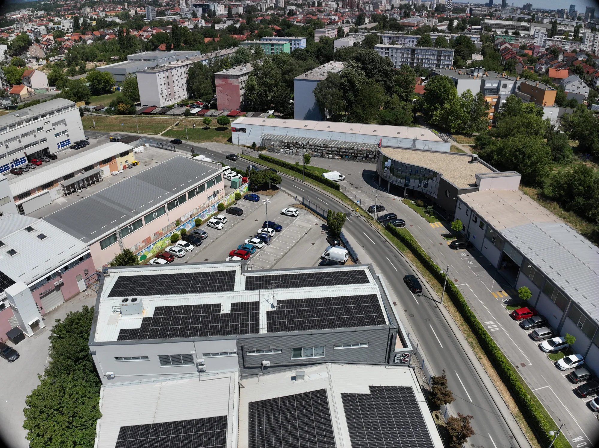
Oblique aerial shot of a commercial complex and the surrounding neighbourhood 02 Application

New builds and project presentations

For investors, an aerial shot helps show the architecture, entrances, parking, greenery and connection to the surroundings. Filming can be timed with a key stage of landscaping so the site looks tidy and credible. We do not add elements that do not exist; editing improves legibility, colour and the flow of the story.

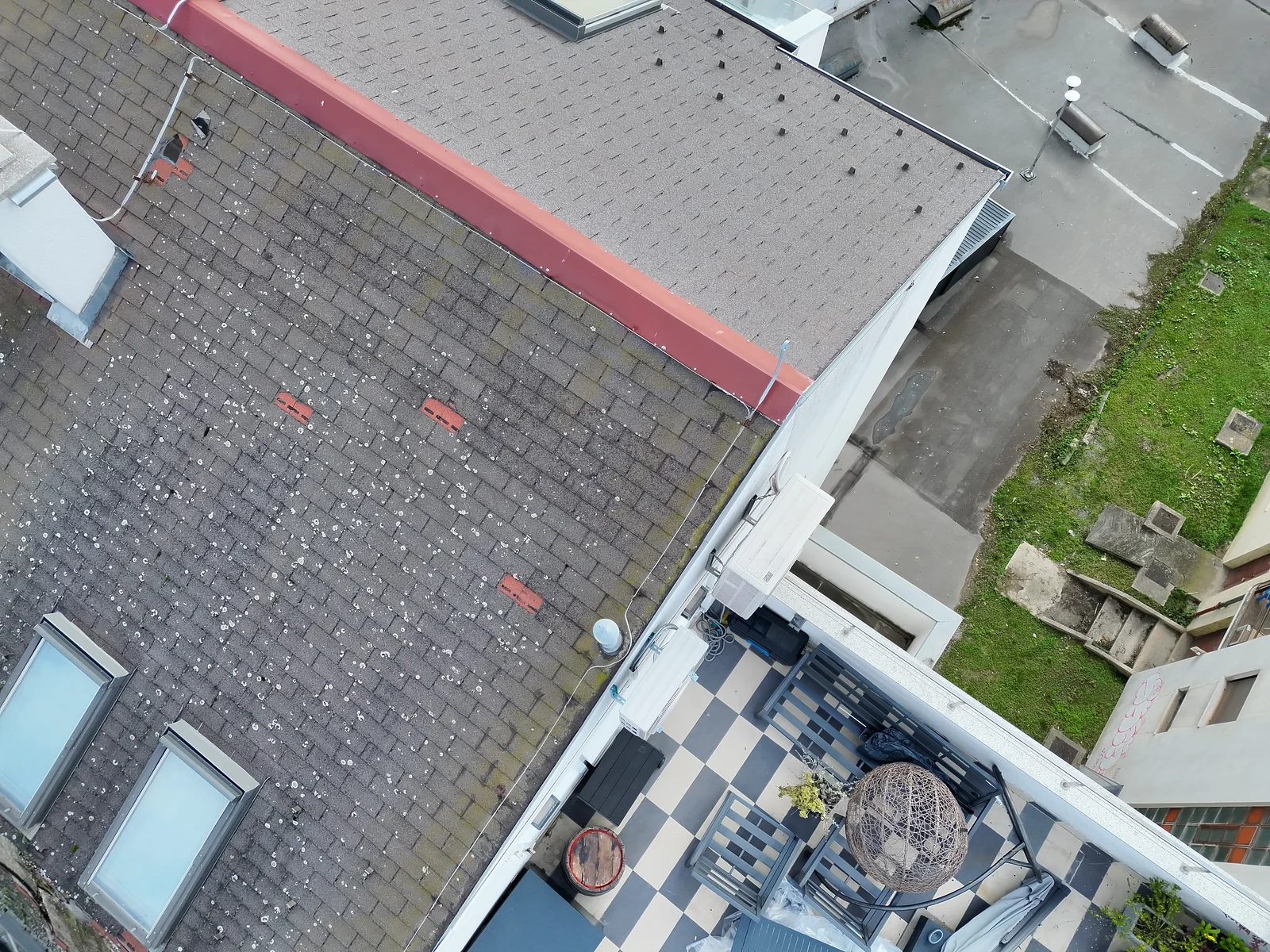
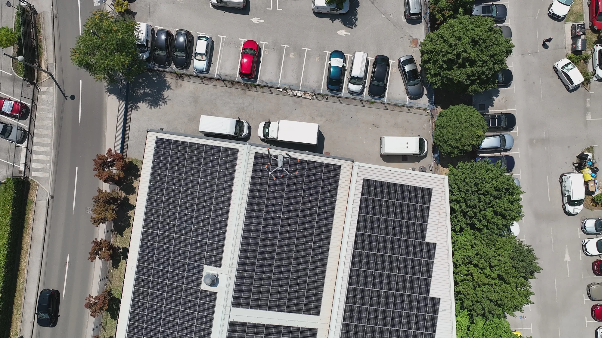
Top-down aerial shot of a commercial building for comparable site records 03 Application

Monitoring construction progress

Repeating predefined angles makes it easier to compare phases of work and report to people who are not permanently on site. The material is organised by date and position, and technical documentation can be kept separate from the promotional video if needed. A drone does not replace site supervision; it provides a clear visual record.

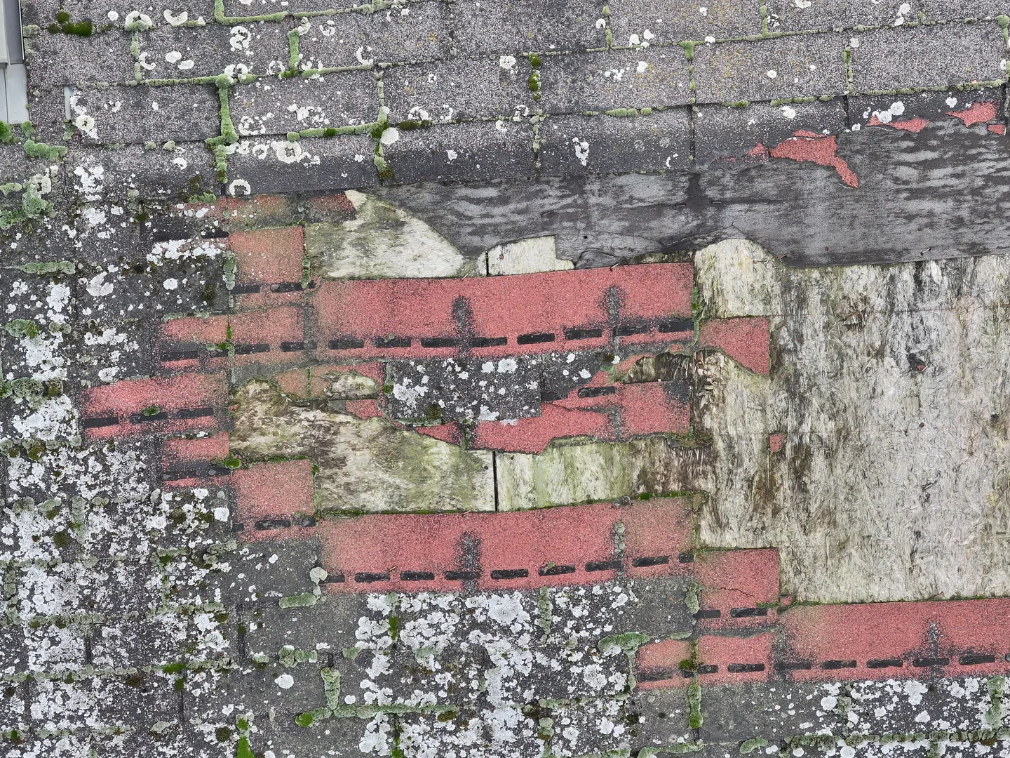
Detailed aerial photo of a roof surface for reviewing its current condition 04 Application

Roof, facade and existing condition

Close-up photos can document visible parts of the roof, chimneys, gutters or facade before deciding on a detailed inspection. The survey reduces the need for access just for an initial visual check, but it does not confirm the hidden condition of the structure. A separate thermal mission can be planned for temperature patterns.

[From enquiry to delivery]

What the process looks like

A good result depends as much on preparing the location as on the flight. Weather, the position of the sun, parked vehicles, ongoing work and the desired atmosphere all affect which shots make sense.

01

Brief and usage rights

We agree on the purpose of the material, publishing channels, video length or the number of photo types, and the key features of the property. The owner or client confirms access to the location and the right to film. Neighbouring plots, people, licence plates and other privacy elements are given special consideration.

Indicative timeline: confirmed in the quote after reviewing the site.
02

Shot and flight plan

Using a map and photos of the location, we choose the main axes, safe take-off points and camera movements. We check the airspace, obstacles and environmental conditions. The plan remains flexible enough to make use of better light on site or avoid unwanted traffic in the shot. Where applicable, we check Croatian Civil Aviation Agency (HACZ) procedures, airspace conditions and use of the AMC Portal before confirming the flight.

Indicative timeline: confirmed in the quote after reviewing the site.
03

Photo and video capture

We film wide establishing shots, the relationship between the building and the plot, and the details that matter for the story. Camera movements stay calm and deliberate, and photos are taken from several useful heights. The operation is stopped if the safety of people, traffic or property cannot be maintained.

Indicative timeline: confirmed in the quote after reviewing the site.
04

Selection, editing and delivery

We choose shots that complement each other, correct the basic tone and prepare the agreed formats. Video editing follows the purpose of the presentation and avoids unnecessary effects that distract from the property. The client receives a clear set of files for the agreed channels.

Indicative timeline: confirmed in the quote after reviewing the site.
[Equipment and data]

Equipment chosen to suit the task

For real estate we use stabilised cameras and a platform suited to the space around the building. For technical documentation or a larger project we can add another sensor and spatial processing, but only when it brings real benefit.

01Equipment

Compact aerial camera

A stable platform allows smooth movements and detailed photos with less visual impact on site. The choice of drone depends on the space, wind, obstacles and the airspace environment.

See our fleet
02Equipment

3D model and orthophoto

For construction sites, larger plots or spatial documentation, conventional filming can be supplemented with photogrammetry and an organised model of the site.

Land and 3D surveying
03Equipment

Thermal inspection of the building

If the goal is not promotion but detecting temperature patterns on the roof or envelope, a separate thermal mission with suitable conditions is planned.

Thermal inspection of a building
[Locally and across Croatia]

Service area

We film in the districts of Trnje, Novi Zagreb, Maksimir, Črnomerec, Trešnjevka, Dubrava and Sesvete, as well as in Velika Gorica, Samobor, Zaprešić, Dugo Selo and Sveta Nedelja. Depending on the project, we also travel to other parts of Croatia. Whether a flight is possible depends on the exact address, airspace, people and traffic around the building, weather and an available safe area. For an assessment, send the location, a few photos, the purpose of the material, the desired formats and when the property will be ready for filming.

Aerial view of an industrial roof and neighbouring buildings
[Transparent assessment]

Price of real estate drone photography

We do not publish a made-up starting price before the actual scope is confirmed. We prepare the quote after reviewing the site, the survey goal and the expected deliverables, so the items and limitations are clear before a date is agreed.

What affects the price

The scope is mainly affected by the location, size of the building, number of photos, video length, filming date, editing required and how the material will be used. Additional regulatory procedures, travel costs or repeat shoots are listed separately when needed.

How to get an accurate quote

Send the location or a map link, the approximate area, the purpose of the material, the desired format and the deadline. We will reply with the proposed method, quote items and a realistic date.

[FAQ]

Frequently asked questions

The answers explain the general process. Exact feasibility depends on the location, airspace, weather, equipment and the purpose of the data.

Send another question
Can any property in the city be filmed?

Not necessarily. Whether a flight is possible depends on the airspace, the proximity of people and traffic, obstacles, the operation category and a safe take-off zone. Before confirming, we check the exact location and propose a feasible approach. If a safe and compliant flight cannot be organised, we say so clearly before arriving.

Do I get photos and video?

The scope is agreed according to your purpose. A project can include only edited photos, only an edited video, or a combination. We define orientations, an approximate storyline and the publishing channels in advance so you get useful material, not a large number of very similar files without a clear selection.

Can you film interiors with a drone?

This service is primarily intended for exterior aerial views. Indoor flight has different safety conditions and is not automatically included. Interiors are usually better captured with a conventional stabilised camera. If there is a particular industrial or spatial reason, feasibility is assessed separately. For a definitive answer we first review the specific site, goal and conditions of the planned activity.

What should we prepare before you arrive?

We recommend tidying visible outdoor areas, removing unnecessary items, arranging parking and informing people on site. Tell us which features should be highlighted and what must not appear in the shot. The owner or client should provide access and confirm that they are entitled to order the shoot. For a definitive answer we first review the specific site, goal and conditions of the planned activity.

Can a technical inspection of the roof also be done?

Separate visual documentation of the roof with more detailed shots can be arranged. It shows the visible condition of the surface but does not replace an expert inspection of the structure. If thermal patterns matter, a thermal camera and a time suited to the measurement goal are needed, which is planned as a technical mission.

[Next step]

Request a quote

Send the property address, a few photos from the ground and explain where the content will be used. Tell us whether you need photos, video or documentation over several dates. We will propose a sensible shot list and check the conditions at the location.

Energize Intelligent Solutions d.o.o.
Trnjanski nasip V. 28, 10000 Zagreb, Croatia
+385 95 822 6318 · [email protected]
Mon–Fri 08:00–17:00