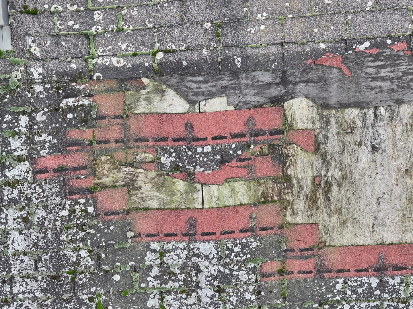
Aerial view of a visibly damaged roof surface
Services / [Photo / thermal / 3D / spatial extent]

Drone damage documentation for expert assessment

A drone allows a fast and clear record of the visible aftermath of storms, fires, floods, landslides or crop damage, especially when access to the whole site is impractical or unsafe. In Zagreb, Zagreb County and elsewhere in Croatia, we adapt the survey to the type of event and the material needed by the person responsible for insurance, remediation or expert assessment. We document the condition as found; the final cause, value and liability are determined by the competent specialists.

01Safety and extentwhat can be inspected without entering a hazardous zone
02Systematic documentationwider context, details and position of findings
03Material for assessmentorganised images, a map or a model as needed
[Short answer]

Who documents damage with drones in Zagreb and Croatia?

EnergizeDrone, a brand of Energize Intelligent Solutions d.o.o. from Zagreb, captures clear RGB, thermal and spatial images of damaged buildings, crops and hard-to-reach sites. The material is organised by area and the agreed purpose so that a loss adjuster, insurer, agronomist or other appropriate specialist can use it for further checks.

01Documentation

Overview and detail in the same set

EnergizeDrone plans shots that show how the damage relates to the whole building or plot, and then records the accessible details. Scope, resolution, thermal views and labelling are agreed before going out.

When a thermal inspection helps
02Responsibility

Footage does not determine the cause or value of the damage

A drone documents the visible condition and spatial context. The final cause, extent of liability, value of the damage or structural safety is determined by a specialist authorised for that type of assessment.

[Applications]

When this service gives you useful data

After an event, the most important thing is to preserve a credible record of the condition without exposing people to further danger. An aerial survey does not replace emergency services or a structural engineer, but it can show the extent and guide a safe detailed inspection.

Detailed aerial image of damaged roof elements 01 Application

Roofs after a storm or hail

Images from several angles can show missing elements, visible displacement, punctured or damaged zones and their relation to the whole roof. The operator does not enter an unstable area just to take a photo. The material is organised so that the loss adjuster can link each detail to a part of the building.

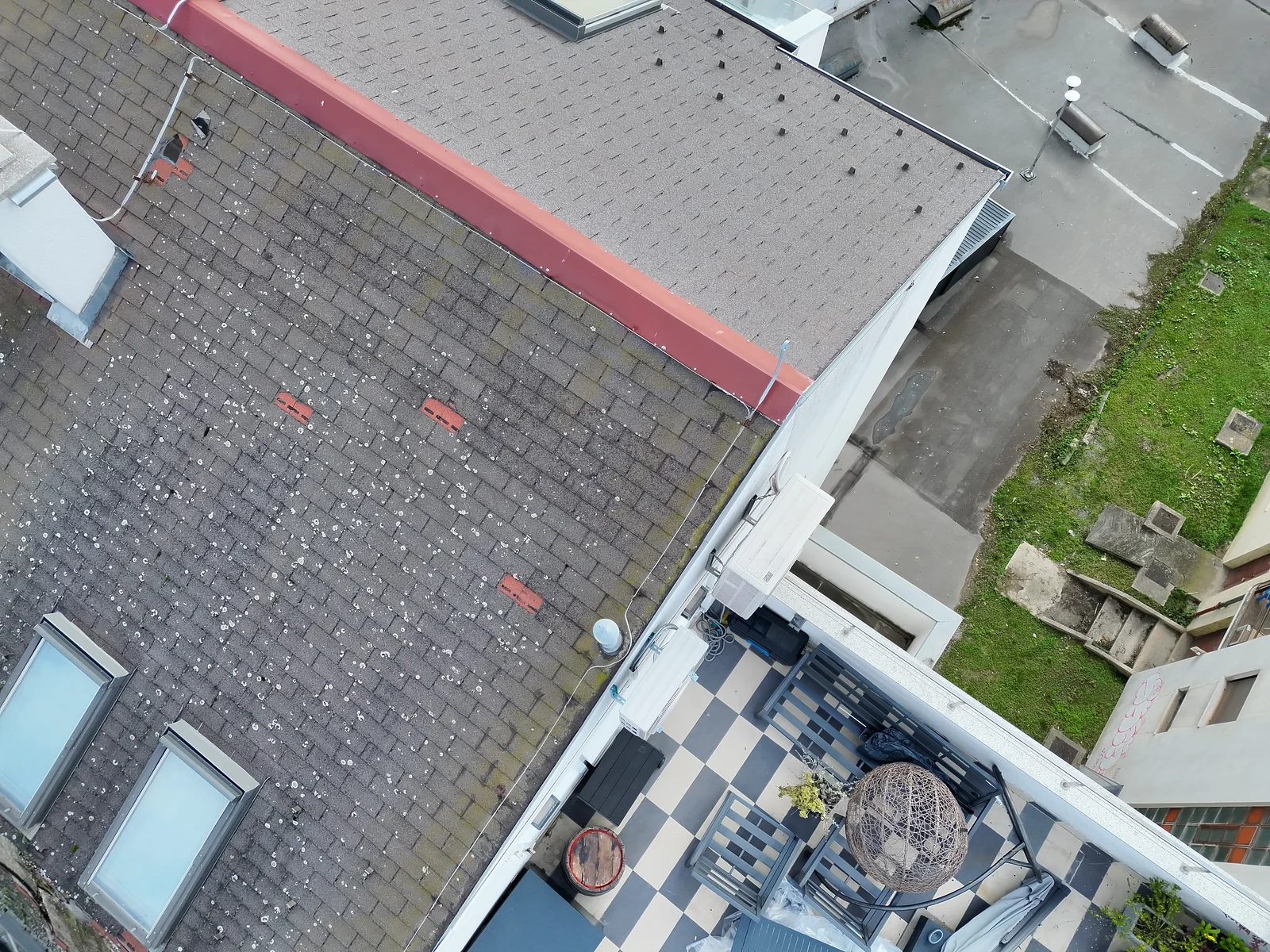
Wider aerial view of a roof, neighbouring buildings and access areas 02 Application

Wider view of the building and surroundings

An aerial shot can document how the damaged zone relates to the whole building, access routes and surrounding areas. Site boundaries and earlier images, if available, are useful for comparison. The drone does not take part in rescue operations without coordination with the authorities and does not interfere with emergency services.

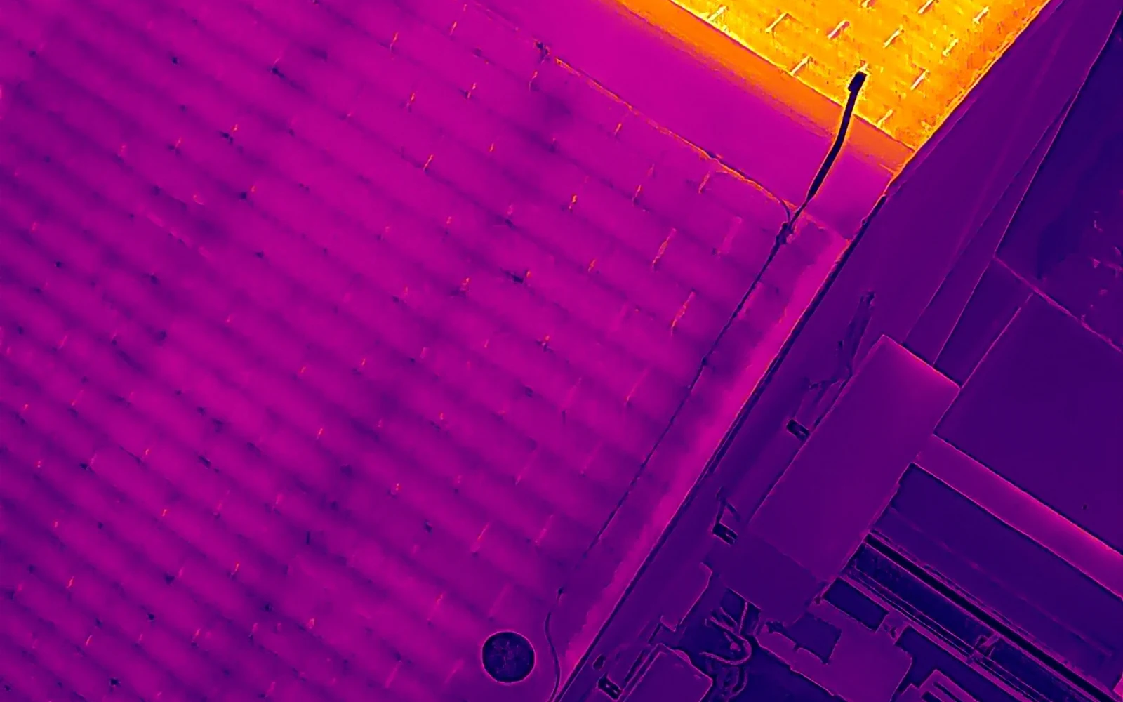
Thermal view of a roof surface to help document an incident 03 Application

Fire and industrial incidents

Once the responsible person confirms that access to the airspace is safe, a drone can provide a view of the roof, structure and surroundings without unnecessary approach. A thermal sensor can show temperature patterns on the visible surface, but it does not replace a fire safety assessment or confirm that the site is safe to enter.

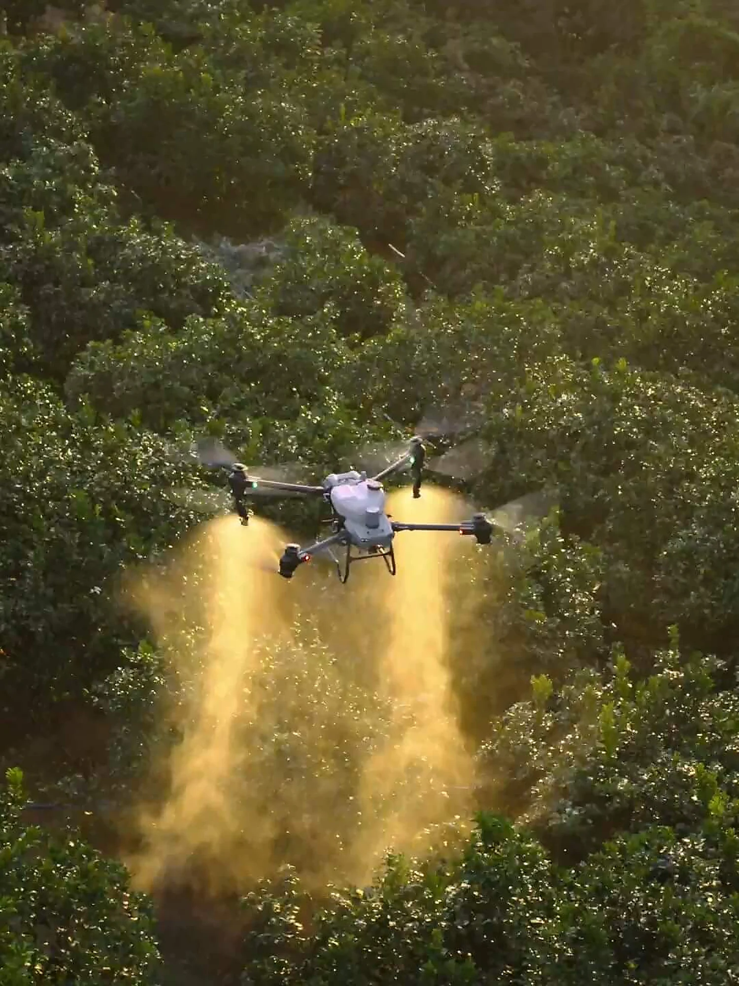
A real agricultural drone platform at work over an orchard, as context for documenting a field 04 Application

Damage to crops and land

RGB and multispectral data can help show the spatial pattern of lodging, water, erosion or other visible changes in a field. The findings are compared with field records and data available from before the event. The assessment of financial loss and cause is carried out by an authorised or responsible person.

[From enquiry to delivery]

What the process looks like

The process is adapted to the safety of the site. If there is active danger, the work of the emergency services takes priority, and the survey is carried out only when the responsible person confirms the conditions and the flight does not create additional risk.

01

Gathering facts and approval for access

We ask for the exact location, type of event, time it occurred, known hazards and the contact details of the responsible person. We check who manages the site and may approve access. We do not enter areas that are closed or unsafe, and we do not present the survey as an emergency response.

Indicative timeline: confirmed in the quote after reviewing the site.
02

Documentation plan

We agree which parts should be covered, from which angles and with what reference context. Airspace, obstacles and safety distances are checked. When a map, thermal record or 3D model is useful, the flight plan is adapted to those deliverables before starting. Where applicable, we check Croatian Civil Aviation Agency (HACZ) procedures, airspace conditions and use of the AMC Portal before confirming the flight.

Indicative timeline: confirmed in the quote after reviewing the site.
03

Capturing the overall picture and details

We first record the site as a whole, then visible details without risky approach. Shots are taken systematically so it is clear where each detail is located. We record the conditions and do not move objects or intervene at the scene.

Indicative timeline: confirmed in the quote after reviewing the site.
04

Organising the material

Photos, video and other data are sorted by zone and type of finding. If needed, we produce an overview map or spatial model. We describe what is visible, without inventing a cause or value of the damage. The client submits the material to the insurer, structural engineer, agronomist or other responsible specialist.

Indicative timeline: confirmed in the quote after reviewing the site.
[Equipment and data]

Equipment chosen to suit the task

The choice of sensor depends on the type of damage. An RGB camera provides a detailed visual record, a thermal camera shows the temperature patterns of an accessible surface, and photogrammetry helps combine multiple images into a spatial whole.

01Equipment

DJI Matrice 4T

Combining a visual and a thermal sensor is useful when temperature context needs to be recorded alongside surface detail. A thermal finding remains subject to expert interpretation.

See the DJI Matrice 4T
02Equipment

3D site map

For a larger extent or a comparison of zones, an orthophoto, point cloud or surface model can be produced. The method is chosen according to the loss adjuster’s needs.

Land and 3D surveying
03Equipment

Agricultural analysis

For crop damage, multispectral views can complement RGB documentation and help select zones for field inspection.

Agricultural drone services
[Locally and across Croatia]

Service area

We organise documentation in Trnje, Novi Zagreb, Maksimir, Črnomerec, Trešnjevka, Dubrava and Sesvete, as well as in Velika Gorica, Samobor, Zaprešić, Dugo Selo and Sveta Nedelja. Depending on the type of event, we also work elsewhere in Croatia. Availability and the start of the survey depend on safety, access, airspace, the work of the emergency services and the weather. For an initial assessment, send the location, a few ground photos if it is safe to take them, a description of the event and the contact details of the person who manages the site.

Aerial context of a roof and surrounding areas before a detailed inspection
[Transparent assessment]

Price of drone damage documentation

We do not publish a made-up starting price before the actual scope is confirmed. We prepare the quote after reviewing the site, the survey goal and the expected deliverables, so the items and limitations are clear before a date is agreed.

What affects the price

The scope is mainly affected by the area and accessibility of the site, the type of damage, the number of shots required, a coverage map, urgency and the content of the material for expert assessment. Additional regulatory procedures, travel costs or repeat surveys are listed separately when needed.

How to get an accurate quote

Send the location or a map link, the approximate area, the purpose of the material, the desired format and the deadline. We will reply with the proposed method, quote items and a realistic date.

[FAQ]

Frequently asked questions

The answers explain the general process. Exact feasibility depends on the location, airspace, weather, equipment and the purpose of the data.

Send another question
Can drone footage replace a loss adjuster?

No. A drone captures visual, thermal or spatial data and helps show the extent, but it does not automatically establish the cause, liability or monetary value. Those conclusions are made by the insurer, a structural engineer, an agronomist or another appropriate specialist. We tailor the deliverables to the information that person needs for their work.

Can you fly immediately after a storm or fire?

A survey can only be planned once conditions are safe and it does not interfere with emergency services or site security. Active danger, strong wind, precipitation, smoke, a closed area and airspace restrictions can delay the flight. We do not promise a response time before checking these facts.

Are the photos acceptable to insurers?

Every insurer and procedure has its own requirements, so before the survey we recommend checking what the loss adjuster expects. We can organise images by location, zone and type of visible damage and preserve the context. We cannot guarantee in advance that a given format will be sufficient for every claim.

Can a thermal camera find hidden damage?

A thermal camera sees the temperature pattern of an accessible surface and cannot see through a wall, roof or the ground. An unusual zone may be a reason for further checks, but on its own it does not confirm a hidden cause. Conditions, reflections and the surface material must be taken into account when interpreting it.

What information should I send?

Send the address or coordinates, a description of the event, the approximate extent, known hazards, ground photos if already available and the contact details of the responsible person. Tell us who the documentation will be submitted to and whether they have a list of required shots or formats. This lets us propose a safe and meaningful plan.

[Next step]

Request a quote

Send the location, type of event, any photos you already have and the contact details of the person responsible for access. If the loss adjuster or insurer has special requirements, attach them before the survey so the material is organised according to the actual need.

Energize Intelligent Solutions d.o.o.
Trnjanski nasip V. 28, 10000 Zagreb, Croatia
+385 95 822 6318 · [email protected]
Mon–Fri 08:00–17:00